
Keshcorran [Ceis Chorainn]
Good walks are even better shared.
Overview
Keshcorran [Ceis Chorainn]
Keshcorran, standing at a proud 587 meters, may not be the tallest mountain in Ireland, but it easily holds its own in terms of beauty and geological intrigue. Situated in County Sligo, this Marilyn offers spectacular views and a rich tapestry of winding trails for those keen to explore its surroundings.
Geology
Limestone reigns supreme here, creating a unique karst landscape adorned with caves and sinkholes. Fossils found in this ancient rock tell of a time when this terrain was under water, offering a glimpse into the geological history of the region.
Routes
The Keshcorran Circular Route is a highlighted path, which spans a comfortable 5 kilometers and can be completed in about 2.5 hours at a moderate pace. This enchanting walk wraps around the mountain's base, revealing stunning viewpoints perfect for a selfie with the summit in the background.
For the more adventurous spirit, the Assaroe Loop offers a challenging 10-kilometer trek. This route leads through lush forest trails and rolling grassland, culminating in stunning summit views that’ll make your legs forget just how long they’ve been active!
Summit Features
The summit itself boasts a trig point which acts as a beacon for many hikers. It’s not just a navigation aid; it’s a fantastic spot to pause, take in the views, and reflect on life’s little quirks. Don’t forget to capture the moment!
Terrain Type
Expect a mix of grassy terrain and rocky outcrops. A word to the wise: keep your footwork nimble, as the area may feature boggy sections threatening to take your boots hostage.
Views
Once crowned at the summit, bask in panoramic views that stretch over Lough Gill and beyond. Benbulben looms majestically in the distance, while on exceptionally clear days, the glistening Atlantic can be seen—offering an inspiring reminder that adventure awaits just over the horizon.
Hazards
Be vigilant of the unpredictable Irish weather—a sudden downpour can turn a trail into a slippery slope. After rain, the trails can get quite boggy, so keep a sturdy grip!
Access
Nearby parking can be found at G712126, but heads up: this little spot fills faster than you can say 'Is it time for my lunch?', especially on weekends. Public transport options are minimal; hence a taxi from Sligo Town is highly recommended for the last leg.
Facilities
While there are no facilities directly at the mountain, you're not far from the village of Ballisodare—a charming stop for a cup of tea and a bun, should you need to refuel post-hike!
History
The name Keshcorran, or 'Ceis Chorainn', hints at its ancient cultural significance. This mountain bears witness to local legends and burial sites, adding a layer of historical richness to your hike.
Get your walking boots ready and don’t forget the camera; Keshcorran is calling, and you wouldn’t want to miss out on this delightful Irish escapade!
Explore routes near Keshcorran [Ceis Chorainn]
Public walks starting within 80 km of this hill. Nearby does not mean a route reaches the summit; check its map and access before setting out.
Route planning notes
These notes describe possible approaches, not verified navigable routes or permission to cross land. Check current paths, local access rules and conditions before setting out.
Keshcorran Circular Route
A scenic circular walk around the base of Keshcorran, offering various viewing points for the summit.
Assaroe Loop
A longer trek featuring forest trails and open grassland leading up to the summit.
Make a day of it, together
Find someone to share the walk with, or organise a day out along a route you like.
Hill facts and local notes
Classifications
Elevation
359m
1,178 ft
Prominence
283m
Coordinates
54.0618, -8.4406
G712126
OS Map
25
At the Summit
The summit is marked by a prominent trig point, providing a perfect platform for a photo op (and justifies that Instagram account you've been working on).
Terrain & Geology
Keshcorran is primarily composed of limestone, which is evident in the area's distinctive karst landscape. The presence of caves and sinkholes adds to its geological interest, and fossil remains found here provide a glimpse into the earth's ancient past.
Views & Scenery
From the summit, you can enjoy panoramic views of the surrounding countryside, including Lough Gill and the distant Benbulben mountain. On a clear day, the Atlantic Ocean may even be spotted in the distance!
History & Heritage
Name Origin
The name 'Keshcorran' derives from the Irish 'Ceis Chorainn', meaning 'the causeway of the crooked place'.
Historical Significance
Historically, Keshcorran is known for its ancient burial sites and has ties to local folklore, making it a significant landmark in the region.
Getting There & Facilities
Check current local access restrictions, parking rules and transport timetables before travelling. These notes do not confirm public access to the summit.
Parking
There is a small car park located at G712126, suitable for a few vehicles. It fills up quickly at weekends.
Public Transport
Local buses connect to Sligo Town, from which taxis can take you closer to the trailhead.
Nearby Facilities
Ballisodare has several cafes and shops, but amenities like toilets are limited once you leave the town.
Safety Information
Known Hazards
- Expect wet and slippery conditions after rain, and be cautious of sudden weather changes typical of the Irish landscape.
General Safety Tips
- Check weather conditions before setting out
- Carry appropriate clothing and equipment
- Let someone know your planned route
- Take a map, compass, and GPS device
- Carry emergency supplies: food, water, first aid kit, torch
Hills
Some common questions about the hills answered
Are there group walks up Keshcorran [Ceis Chorainn]?
Many walkers use Walkmates to join or organise walks with others. You can check for group walks around Keshcorran [Ceis Chorainn] through the maps
Are there other walkers around Keshcorran [Ceis Chorainn]?
Activity varies by location and time, but Walkmates lets you see whether others have shared walks or shown interest in this area. Find other people through the walking friends search walking friends for Keshcorran [Ceis Chorainn] search or of course create your own walk for Keshcorran [Ceis Chorainn]
Can I organise a walk to Keshcorran [Ceis Chorainn]?
Yes. If there aren’t any walks listed already, you can create a walk and make it available for others to join.
If you're signed up to Walkmates, you can create a walk to Keshcorran [Ceis Chorainn].
How do I find a walk up this hill?
There are often multiple ways to walk this hill, depending on experience and route preference. Walkmates helps you explore walks and routes that others have shared.
Can I suggest a new route up Keshcorran [Ceis Chorainn]?
Yes. You can suggest or create routes to share with others. Walkmates focuses on the social side of walking, so routes are used to help people organise walks and explore areas together, rather than as detailed navigation tools or route libraries.
Other uses really appreciate knowledgeable walkers sharing their routes. Share your favourite route to Keshcorran [Ceis Chorainn] here
The is an error or something incorrect about this hill. How do I let you know?
We always strive to keep the information on Walkmates as accurate as possible. If you find an error, please let us know through the contact form and we'll aim to correct it as quickly as possible
Community Discussion
Comments
Location
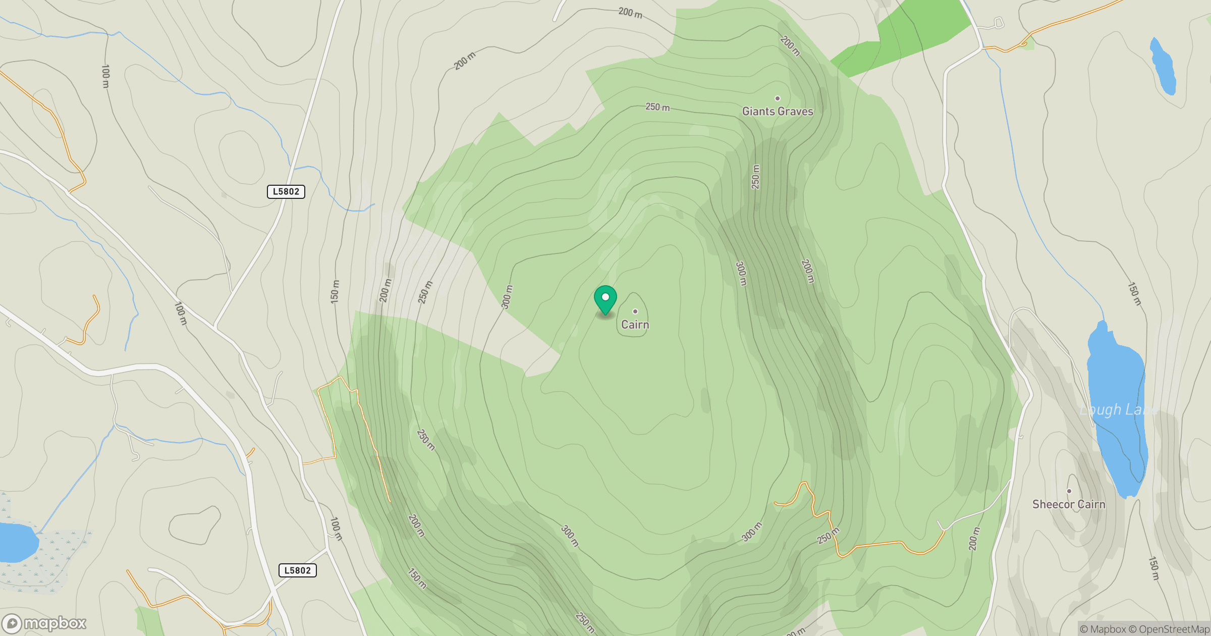
Grid reference: G712126
View on OpenStreetMapOpens a map in a new tab, centred on the hill.
Hills within 30 km
Straight-line distance, not a walking route or confirmation of access.
No comments yet. Be the first.